
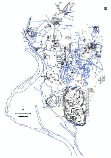
The ASAGE plan of Bust
Our initial focus was on the forty-five known medieval
sites which fall within high resolution Google Earth images of
Afghanistan. Only eight of these sites have even basic plans,
so we have used the Google Earth images to draw detailed sketch
plans and to record and describe standing structures. At sites
such as Bust / Lashkari Bazar, the Ghaznavid (996-1160 CE)
winter capital, our detailed study of the Google Earth images
has added significant detail (Fig. 1) to the plans
published following French work at the site from 1949-52
(Schlumberger 1978). A poster outlining this aspect of our
research was presented at the recent Sixth World Archaeological
Congress in Dublin (Thomas and Zipfel 2008).
The ASAGE plan of Bust
The sketch plan of Qal’a-i Hauz ...
© ASAGE-Project - David C. Thomas, Claudia Zipfel, Fiona J. Kidd und Suzanna Nikolovski